Introducing IAMI

The International Association of Marine Investigators (IAMI) is a non-profit international organization dedicated to combating marine theft and insurance fraud.

IAMI’s Mission

To develop and provide high levels of training to law enforcement, insurance investigators, and other marine professionals. Working and training together with both public and private sectors to combat marine theft, arson, fraud and other criminal activity in the marine environment.

Objectives

The objectives of IAMI, as stated in its constitution and by-laws, are as follows:
• Provide marine theft investigative training;
• Develop and disseminate educational materials to combat marine theft and fraud;
• Provide a forum for the discussion of marine theft and related investigative activities and other topics of interest;
• Promote marine theft prevention and suppression;
• Encourage cooperation between law enforcement agencies and marine organizations;
• Focus on the needs of the marine community;
• Unite for the mutual benefit of those persons who are eligible for membership;
• Accumulate and disseminate information of interest to all members;
• Eliminate all factors that interfere with the administration of justice;
• Operate as a non-profit organization.

Training

Each year IAMI holds two major training seminars. IAMI U.S. holds a three-day seminar and IAMI Europe holds a 1 ½ day seminar in conjunction with their annual business meeting. The training is open to law enforcement, insurance investigators, Coast Guard officials and other marine professionals. Some topics normally covered at the seminars are:
• Marine theft & fraud
• HIN formats
• Trailer serial numbers
• Outboard and inboard serial numbers
• Gaining and dissemination of intelligence;
• Bank & insurance fraud investigations
• Fire/arson investigations
• Updates on changes in Coast Guard regulations and policies
• Admiralty law
• Accident investigations
• Raising, tracing, and lifting HIN’s

Map showing principal boating crime routes. Red numbers: Stolen boats. Green numbers: Recoveries. With kind permission of Boote Magazin, www.boote-magazin.de. Situation as in 2005 - numbers have grown since then.
Map showing principal boating crime routes. Red numbers: Stolen boats. Green numbers: Recoveries. With kind permission of Boote Magazin, www.boote-magazin.de. Situation as in 2005 – numbers have grown since then.

Certified Marine Investigator

IAMI initiated the Certified Marine Investigator training and testing in 2003. This designation will ensure that marine investigators are qualified in various aspects of marine-related investigations; marine terminology, cause and origin of fires, forensic photography, investigative techniques, admiralty law and insurance fraud.
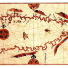
IAMI and Turkey

Turkey is on the crossroads between the West and the East, between South and the North.
The Turkish Mediterranean coastline is scene to marine crime, in particular human trafficking.
The Turkish Straits permit delivery of stolen/ embezzled yachts into the Black Sea – usually a “route of no return”.
Law enforcement agents and Insurance agents have an interest in closing the door for crime between Europe, the Middle East and the Black Sea.

Ibizia: Yusuf during a presentation at the IAMI annual conference in 2013.


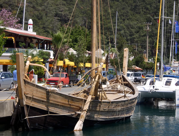
IAMI and marineSOLUTIONS

Principal partner of marine SOLUTIONS, Yusuf Civelekoğlu, was proposed for IAMI membership in 2011 following several successful recoveries which involved networking with IAMI members, in particular recovery of an embezzled catamaran in Bodrum, which had been reported lost on the Seychelles.

Yusuf was elected as member of the IAMI Europe Steering Committee in 2013 and is currently the Chairperson of IAMI-EU. Presently he is co-organising the annual conference to be held in Šibenik, Croatia, in October 2018.

Yusuf is a member of the Certified Marine Investigator examination committee.

marineSOLUTIONS’ partner Capt. Naci Arıcı is also IAMI member.

Please follow the link for the latest IAMI newsletter

IAMI’s History

The concept of IAMI began in 1986 when Major Dave MacGillis of the Florida Marine Patrol organised and published the Vessel Theft Investigators National Roster. The roster was intended to assist investigators combat marine theft, a high profit, low risk crime that was out of control, by providing contact persons from various agencies involved in marine theft investigations. The initial roster contained the names of nearly three hundred law enforcement, insurance industry, and marine community representatives who had agreed to provide assistance in the investigation of marine theft, insurance fraud, or title fraud cases.

In 1989, the first three-day training seminar was held in New Orleans, LA. The following year, 1990, the National Association of Marine Investigators (NAMI) was formed. As NAMI grew, our membership increased both nationally and internationally. In 1996, NAMI became the International Association of Marine Investigators (IAMI). We are now represented by marine professionals from all over the world. Whether your case is local or a country away, IAMI members are ready to lend a hand. Worldwide networking is one of the best benefits of IAMI.

Official IAMI web site

Having Diving Tanks Tested

When I was about sixteen I did what I would never recommend to anyone today: I built my own diving tanks. Three jetfighter crew oxygen tanks from the air force scrapyard and two ordinary industrial valves for oxygen tubes formed the core of the concoction…

Gökova and its Backwaters

The Gulf of Gökova (Gökova Körfezi) or the Ceramic Golf (or Sinus Ceramicus or Colpos Ceramicos) is perhaps the most rewarding cruising area in Turkish waters. Roughly about 40 miles long and about 18 miles wide at its western “mouth,” it narrows down to about 1- 2 miles at its easternmost end. The bottom of the golf has some not much reported qualities and in the following article I will try to pay special attention to them.

Piri Reis about Gökova

The gatekeepers of the Golf are the Cape Hüseyin (N 360 57,9′ E 0270 15,8′) lighthouse at the north shore and the most dramatic Cape Cnidus (N 360 41,2′ E 0270 21,8′) lighthouse in the south, towering over the antique city of Knidos and the “Triremes” port.

When approaching from the NW one will see the Cape Hüseyin (Hüseyin Burnu) lighthouse on the left and the shoals with an unlit beacon on them on the right. Beware, and do not pass between the lighthouse and the beacon except under calm and favorable conditions.

The Cape Cnidus lighthouse on a magnificent rock, as seen from due West.

Gökova: The “Blue Plains” or the “Heavenly Plains”. Both translations are valid. Here are a few hints – telltales for your own discovery.


The Gökova Pages

(Please click the images or the text)

Çelebi (Celibacy) Island,
Bitez, Sigir Island and the Ada
 (Island) Narrows

Çökertme (Basilika) and Ören (Gereme, Keramos)

Oraklar,
Kisle Bükü, Alakisla

Akbük
and Gökova Iskelesi

The
Backwaters of Gökova

Gelibolu,
Cleopatra
Islands, Karacasögüt, English Harbour

Cnidus 
(Knidos, Cape Crio, Tropium Promontorium)

Löngöz,
Tuzla,
The
Seven Islands

The
Idyma Rock Tombs

The Oriental Sweetgum
Tree

Piri Reis in
“Bahriye (Seamanship)
“The Ceramic
Gulf Explained”

The Kiran Poyraz, Katabatic Winds

Prevailing winds

In the summer season the Meltemi wind prevails, which, following the contour of the coast, blows into Gökova. In particular, when you are weathering north from Cnidus towards Bodrum, you will find that when you are on the port tack, it will first appear that you cannot hold the target. Don’t tack mariner – the further your northing is, the more the wind will veer and slowly you will be holding Bodrum. Then, do not forget to cheer for the sailors of the past who used this trick with much less weatherly ships than ours.

In the winter months winds can blow from the northerly directions as in summer or from southerly directions due to the passing lows. While in the summer months there are several safe refuges on the north shore, in winter, under unsettled conditions, almost no refuge is available and you should prefer to stay over night on the south side of the bay.

Often, when following the northern shore, the wind will find a shortcut out of the valleys in the north-south direction and will blow locally from due north. These gusts can be fierce, in particular off the Seytan Deresi (“Devil’s Stream”) and, further east, off Ceramos, present day Ören. Proceeding further east you will finally come to the Mount Kiran, the last outpost of the Anatolian Highlands. Kiran in Turkish means “the Devastator”.

The “Admiralti Haritasi” or the Chart of “His Majesty’s” Admiralty

One of the first sea charts I ever possessed was “The Gulfs of Kos, Doris and Symi,” the Chart Number 1604, by the Hydrographic Office of the Admiralty. I was sixteen when I saw this masterpiece of marine art at a chandlery in Karaköy, Istanbul. Deeply interested in the “mysteries of navigation,” I could not resist the temptation to own it, although it was expensive for a humble student such as myself. At the time I did not know that I had bought the principal chart of the area, as I believe all the later charts were based on that survey. Unfortunately I lost that copy, though I am still in the possession of the next one I purchased from Bade & Hornig in Hamburg in 1979. It was my reliable companion when I discovered Gökova for myself in 1979 – on an inflatable; but this is a different story.

The area was surveyed by HMS Beacon in 1839. The engravings in this article are from that chart. Depths are in fathoms, heights are in feet.

Commander T. Graves was in charge and there were archeologists and scientists with him. HMS Beacon surveyed Xanthos in Lycia and removed the famous reliefs of the “Xanthos Grave” to London. Today Xanthos has to display plaster placeholders of the marble originals. Incidentally, Commander Graves was murdered a few years later in Malta.

The Chart Legend
The Hydrographic Office of the Admiralty
Mediterranean
Asia Minor
The Gulfs of Kos, Doris and Symi,
Chart Number 1604

The Ancient Sinus Ceramicus and Sinus Doridis
Surveyed in HMS Beacon by Commander T. Graves, F.R.A.S. and Commander T. Brock
1839
Engraved 1844

Piri Reis in “Bahriye (Seamanship)” about Gökova

Description of Gökova by Piri Reis, brilliant Turkish Admiral, Cartographer and Scholar of the 16. Century.

Cevat Sakir Kabaagaçli or “The Fisherman of Halicarnassos”

(Crete, 1886 – Izmir, 1973)

No account of Gökova would be complete without mentioning Cevat Sakir, “The Fisherman of Halicarnassos” (“The Fisherman” in short), a famous Turkish writer of novels, short stories, essays, as well as a passionate ethnographer. Cevat Sakir, a descendant of Ottoman Nobility, the son of Sakir Pasa, is only but one of the numerous artists emerging from this family. Starting, at a young age, to question the dull education he became exposed to in Istanbul through American missionaries, he would, later, go on to study ancient languages and history at Oxford. Together with his profound knowledge of eastern languages and cultures, Cevat Sakir developed into a major and native source of Anatolian culture and history.

In 1925, as a result of an article he wrote about the plight of the deserters from the army who were about to be hung, he was sentenced to a three-year exile in Bodrum. However, in his own words, “the real captivity started when he was released and expected to get back to Istanbul.” Cevat Sakir decided for Bodrum, for Gökova, for the simple but humane life amidst the blue and the green he much adored and wrote about.

I hope to write more about Cevat Sakir later. Below please find his photography by another brilliant artist, the forgotten Turkish woman photographer Yildiz Moran Arun.

Ottoman Sailing Ships (A remarkable book)

Mr. Ahmet Güleryüz, the distinguished artist and author of several maritime books, including the well known study of THE OTTOMAN STEAM NAVY [1]has just come up with a very remarkable book.

Ottoman Sailing Ships from Galleys to Galleons
Particulars of Ships and Their Equipment

This is a Turkish/English study of the Eastern Mediterranean ships. It starts with the galleys of the thirteen and fourteen centuries and includes, furthermore, a transliteration of Diyarbakirli Abdülhamit’s Particulars of Ships and Their Equipment [2], a navy technical handbook from the beginnings of the nineteenth century, describing the sizes, the weights and the equipment details of the Ottoman Navy Sailing Ships, giving their sail plans with the centers of forces, the conversion tables to European units and much more.

The book contains a wealth of very detailed and most enjoyable drawing foldouts by the author, the details of the miniature and copper engravings, the old scantlings, some photographs of the vessels that survived into the age of photography… Every page of this book can be recommended wholeheartedly to the interested mariner.
The book’s price of approx. € 50.00 is well worth the money. It can be obtained through Denizler Kitabevi, Istanbul.

OSMANLIDA YELKEN VE MIKYAS-I SEFAIN
Ahmet Güleryüz
Denizler Kitabevi (September 2004)
ISBN 975–98677–0-2
www.denizlerkitabevi.com
Cpt. Turgay Erol


[1] THE OTTOMAN STEAM NAVY 1828 – 1923, by Bernd Langensiepen and Ahmet Güleryüz, Conway Maritime Press (1995)
ISBN 0 85177 610 8
and
OSMANLI DONANMASI 1828 – 1923, by Bernd Langensiepen and Ahmet Güleryüz, Denizler Kitabevi (2000), Istanbul, ISBN 975-94818-2-0, in Turkish/ English
[2] In this edition the “Particulars” are predominantly kept in Turkish; it would be most welcome that an English translation will follow in the next editions.

Rod Heikell’s Comments on the dilemma Skylax versus Pseudo-Skylax

In addition to being the author of the most accurate coastal handbook of Turkish Waters, Rod Heikell has a solid background and ongoing interest in the philosophy of scientific progress. As expressed in my brief article about Skylax, this ancient voyager seems to be a milestone in the history of “handling science,” and Rod had noticed this article. During a wonderful evening in Gumusluk, Rod, Lou and myself had the opportunity to let our fantasies go around Skylax, Piri Reis and others who bothered to write down geographic observations several thousand years ago and enriched our lives today. Later Rod sent me two mails, which, until we shall know more, I copied below without comments, but with some emphasizing:

The first mail is of 25 October 2004:

“Dear Yusuf,
At odd moments I have been pursuing the Skylax story. I went to your web site and I think there is a fundamental error here over Skylax. You mention Pseudo-Skylax as a separate person, but I believe that the Periplus of Pseudo Skylax, which is the one that survives, is the same Skylax of Karyanda. It is called Pseudo Skylax I believe because it is not the original written by Skylax, but a later copy (as most of what we have from this time is).
I have contacted a few people in the antiquity departments of various universities for enlightenment. (…) The Periplus of Skylax (or Pseudo Skylax) by the way has nothing on his voyage to India, but is solely a pilot for the Mediterranean and the Black Sea. We only know Skylax went to India through Herodotus (as the earliest reference) and he could at times be a little inaccurate in as much as he reported things he heard as his own experiences.

Anyway thought you might be interested.”

and then on 28 October 2004 upon a reply from the University of Leeds:

“(…) the question of authorship and just who Skylax was is as murky as you get. Wonderful academic detective work: I love it.”

Anyway below is the reply from Graham Shipley on Skylax and Pseudo-Skylax:

There is a vast literature (in relation to the size of the text!) about the authorship of the work, which survives in only one medieval copy and a few later manuscripts that derive from it (if I remember right). There it is under the name of Skylax of Karyanda, who is mentioned by Herodotos in the 5th century BC and lived at the end of the 6th. But evidence from within the text proves that it must date from the mid-4th century BC, in which case we simply do not know the name of its author; hence the appellation ‘Pseudo-’. The question is, does any part of the text originate earlier, and is any part the work of the real Skylax or not? There are diametrically opposed views on this!

Independently, between 7 and 11 fragments (i.e. quotations or paraphrases in later authors) have been identified from the original Periplous of Skylax of Karyanda, some referring to India.

Does this help you? What is your interest in, and involvement with, Pseudo-Skylax?”

Those really interested in this subject may click here to get to a preliminary translation into English of the Periplus of Pseudo-Skylax by Prof. Graham Shipley.

ULUBURUN II – A Cargo Vessel of 1300 BC

IMG_7717

These days Netsel Marina in Marmaris is hosting the most unusual vessel. Granted that, if we would disregard the two side rudders in plantain timber, the several stone anchors and, of course, the massive square sail, she is perhaps not too different from the cargo vessels of the Med, which one could have seen as late as the second half of the twentieth century. Who would nowadays sail such a vessel?

This project is the brainchild of the group named 360 DERECE, translated as 360 Degrees, a dedicated group of scientists from various disciplines and craftspeople. Their aim is to rebuild and reconstruct historic vessels and their program is diverse: Next to this replica from the Antiquity, one can see the famous “Kayik”s of Izmir, a “Trireme,” the galley of the Antiquity; a “Tirhandil”, the trading and sponge diver vessel of the Aegean Sea – all of them are among their objects of interest.

For the wreck site location click map.
For the wreck site location click map to the right.

The Uluburun wreck was discovered by a sponge diver named Mehmet Cakir in 1982 off the Cape of Uluburun, close to Kas (N 360 07,9′ E 0290 41,0′) in southern Turkey near Antalya. Her stern rested at the depth of 44 m and her bow at 52 m. Some of the artifacts were at 62 m. The National Geographic Society provided the means for the excavation in the 1984 work by the team under Prof. George Bass of Texas A&M University. After an incredible number of more than 22.400 dives, the puzzle surrendered itself sufficiently to a reconstruction attempt, thus came into existence the Uluburun II.

The antique vessel sank in a storm around 1300 BC. It was the time of the Bronze Age, the steel not discovered yet. Indeed her main cargo consisted of copper and tin ingots, the raw materials necessary for making bronze. Next to the main cargo were a huge number of very valuable artifacts, including the seal of Queen Nefertiti of Egypt, which were salvaged after the “long sleep”. The excavated remains of the original vessel rest today in the Underwater Archaeology Museum of Bodrum, located in the Crusader’s Castle of Bodrum.

For more information about the the Uluburun Wreck please click here.
Below are the pictures of the vessel, which is presently preparing for a ring tour of the Eastern Mediterranean.
Fair Winds, Uluburun!

The “Swallows Tail” scarp, caulked only where caulking makes sense. These and other details show that already in the Bronze Age vessels of high sophistication were built in the Eastern Med.
View into the holds. Today it doubles as a cozy cabin for the crew.
The famous stone anchors. 1300 BC – even the wooden anchor is yet to be discovered.
Two sophisticated and huge side rudders, similar to oars serve to control the vessel. They are made of plantaine timber. The rest of the vessel is made of pine, in lieu of cedar, which is extinct in the Lebanon and under protection on the Turkish Taurus mountains.
Leaking caulking – the ancient mariner had to fight these leaks as much as today’s seamen.
The new meets the old. An Azimuth motor cruiser in the background and a plough anchor next to a stone one.
The “Tabled and Hooked Scarp” or the “Phoenician Scarp” of the Romans, a principal shipbuilding element still today.

“SCARF or SCARPH, the joining of two timbers by beveling off the edges so that the same thickness is maintained throughout the length of the joint. In the construction of a wooden ship, the stem and sternposts are scarfed to the keel. A scarf that embodies a step in the middle of the joint, so preventing the two parts from drawing apart, is called a lock scarf. It is a joint of great antiquity, having been used by the early Egyptian and Phoenician shipbuilders.”


The Oxford Companion to Ships and the Sea, p. 756
Peter Kemp, editor,
Oxford University Press, 1976 and 1988
(as quoted here)


The Gulet

The Gulet, as seen by artist Suat Yurtalan ®
The Gulet was one of the most beautiful boats among the many that populated our seas in the age of sail.
La goletta fu una delle piu belle imbarcazioni fra le tante che popolavano i nostri mari all’epoca della marina a vela.
“Vele Italiane della Costa Occidentale” by S. Bellabarba and E. Guerreri
published by Hoepli in Milan in 2002.
Lubnan_Gulet

Above is a Lebanese cargo gulet (pronounced as goolet) under sail. In today’s terminology that is in effect in Turkey, where gulets are still built, she would not be a gulet because of her transom and an external rudder. However, in the heydays of cargo gulets she was one. Here we have a ship of 100 feet or so. Here the gulet is Marconi rigged and therefore, the main boom is overhanging the transom by about 15 feet. Compared to the above example, the gaff rigged gulets have much reduced overhangs. Note the huge bow sprit and the “velene” or the staysails. Note also the tiny figure just ahead of the main boom gallows. He is the helmsman! And he steers this enormous vessel on a tiller! A well balanced vessel, indeed. Note her rather steep forefoot.
Image: H.M.Denham, The Eastern Mediterranean, John Murray, London, 1964

A cargo and fishing ship of the Mediterranean, the gulet has survived in the Eastern Med up to our days, and Bodrum is certainly the center for having a gulet built. Her lines have always attracted many a boat designer, including, for example, the famous British design house of Laurent Giles. Nevertheless, none of these boats come close to the flair achievable through the legendary shipwrights of Bodrum.

  • The gulet goletta as seen by Edouardo Guerreri

    The “goletta” as seen by Edouardo Guerreri. She is a two-masted schooner and, like with all schooners, the overhanging mainsail and the numerous jibs provide its main sailing drive. Its clipper bow, almost vertical under the waterline, is paired with, likewise, a clipper stern. Her flush deck emphasizes her exceptionally beautiful shear.


  • • However, not all glitter is gold, and so is with the gulet.
    There are many items to be considered before and during the construction and also while owning a gulet. I have highlighted but a few of the relevant points below:
    • Traditionally the Bodrum Gulets are made of “pine on pine”, utilizing the red pine (Pinus brutia Ten.) popular in our area. This is inherently not a very durable choice of wood, causing gulets to rot, particularly in the badly vented aft quarters. Shipwrights are more and more resorting to exotic woods like “khaya” or  “sapelli.” But even these woods cannot be used throughout the boat, certainly not in keel, stems, frames and stringers; these must be made out of more suitable timber.
    • Since almost no “crooks” are available any longer, the frames and the stems are now usually laminated. However, as the planks are still caulked in the traditional manner the resulting “hybrid” is not a satisfactory construction and consequently, the gulets may turn out to be humid and at times leaking boats.
    • Another matter is the use of galvanized iron nails, iron bolts and coach screws; bronze and copper are unheard of. The ferrous elements have a life expectancy of, say, ten or fifteen years. In fact, even before this period, the owner is forced to “refasten” the planks and, where and when this is not possible, to accept a leaking, “softened” boat.
    • In recent times, in order to squeeze in more and more paying passengers into the boats, very unsightly superstructures and unseaworthy flaring ends have been added to these beauties.

I could continue this list with many more items.


Ata Nutku Gulet
Ata Nutku’s Gulet “Çetinkaya”. Ata Nutku (1904 – 1994) was an eminent Turkish naval architect, interested among others in Turkish local boats. One of his projects was to improve the Turkish coasters (such as Çektirmes and Gulets), and thus to improve maritime transport on scientific basis and help evolve coastal vessels in order to resist against the then newly developing road transport. The underlying reason was to contribute to the family-wide operation of boats and to continue with small workshops and handicrafts. However, the Çektirme building was completely erased in the 1980’s. On the Aegean coast, the construction and operation of wooden boats continues thanks to tourism. “Çetinkaya” is a Gulet of the Black Sea and is different from our Bodrum Gulet. Source: İstanbul Teknik Üniversitesi, Gemi Enstitüsü Bülteni, Türk Kıyı Tekneleri, “Çektirme, Gulet”, Ata Nutku, Ord. Prof, Ferhat Küçük, Y. Müh, İTÜ Gemi İnşaatı II. Kürsüsü, Türk Gemi Endüstrisi Kürsüsü, İstanbul, 1963


We would be pleased to assist and advise in the design and supervision of the construction of the finest of the traditional sailing boats here in Bodrum. We can confidently assure that you will end up with a jewel impressing, next to yourself, anybody with a heart for sea and sail.

Not everything that glitters is gold: Gigantic ships they are, yes, but poorly laminated and with already cracked wood, ferrous fasteners, a steel ballast keel envelope, rusting heavily, primitive painting…..already before launching. Therefore please contact us for our services fashioned in accordance with the CE standards and provided through the supervision of naval architects.

Gulets at anchor in front of St. John’s Castle
in Bodrum.
Further gulets in front of the Tepecik Mosque in Bodrum. Note the strongly flaring bows.

Gigantic wooden ships under construction in Bodrum

Photography and text by Yusuf Civelekoglu